
Page 84 - Traffic Infra Tech
P. 84
ITS
implement updated signal phasing plans. The program considers
the network simultaneously, and can therefore integrate traffic
signal controllers at individual intersections to coordinate green
waves along a network, as well as reduce the overall delay of the
network. The model based network control optimizes the signal
programs every five minutes in response to current traffic flows.
Case study
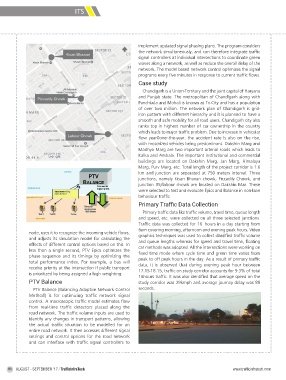
Chandigarh is a Union-Territory and the joint capital of Haryana
and Punjab state. The metropolitan of Chandigarh along with
Panchkula and Mohali is known as Tri-City and has a population
of over two million. The network plan of Chandigarh is grid-
iron pattern with different hierarchy and it is planned to have a
smooth and safe mobility for all road users. Chandigarh city also
ranks top in highest number of car ownership in the country
which leads to major traffic problem. Due to increase in vehicular
flow year0over-the-year, the accident rate is also on the rise,
with motorized vehicles being predominant. Dakshin Marg and
Madhya Marg are two important arterial roads which leads to
Kalka and Ambala. The important institutional and commercial
buildings are located on Dakshin Marg, Jan Marg, Himalaya
Marg, Purv Marg, etc. Total length of the project corridor is 1.6
km and junction are separated at 750 meters interval. Three
junctions, namely Kisan Bhavan chowk, Piccadily Chowk, and
junction 35/labour chowk are located on Dakshin Mar. These
were selected to test and evaluate Epics and Balance in non-lane
behaviour traffic.
Primary Traffic Data Collection
Primary traffic data like traffic volume, travel time, queue length
and speed, etc. were collected on all three selected junctions.
Traffic data was collected for 16- hours in a day starting from
6am covering morning, afternoon and evening peak hours. Video
node, uses it to recognize the incoming vehicle flows, graphics techniques was used to collect classified traffic volume
and adjusts its simulation model for calculating the and queue lengths whereas for speed and travel time, floating
effects of different control options based on this. In car methods was adopted. All the intersections were working on
less than a single second, PTV Epics optimizes the fixed time mode where cycle time and green time varies from
phase sequence and its timings by optimizing the peak to off peak hours in the day. As a result of primary traffic
total performance index. For example, a bus will data, it is observed that during evening peak hour between
receive priority at the intersection if public transport 17.15-18.15, traffic on study corridor accounts for 9.3% of total
is prioritized by being assigned a high weighting. 16hours traffic. It was also identified that average speed on the
PTV Balance study corridor was 29kmph and average journey delay was 88
PTV Balance (Balancing Adaptive Network Control seconds.
Method) is for optimizing traffic network signal
control. A macroscopic traffic model estimates flow
from real-time traffic detectors placed along the
road network. The traffic volume inputs are used to
identify any changes in transport patterns, allowing
the actual traffic situation to be modelled for an
entire road network. It then accesses different signal
settings and control options for the road network
and can interface with traffic signal controllers to
84 AUGUST - SEPTEMBER ’17 / TrafficInfraTech www.trafficinfratech-com-500653.hostingersite.com